GST : 09CBDPR8069N1ZP
Call us
07971670612
Call us
07971670612
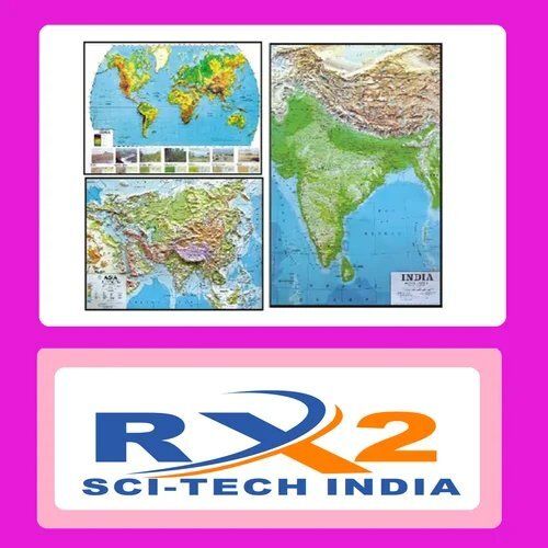

| Size | 75x100cm |
| Language | English |
| Laminated | Laminated Charts |
| Color | as per image |
| Material | Laminated Paper |
| Usage/Application | Educational use |

Price:
Price 1050.0 INR / Piece
Minimum Order Quantity : 5 Pieces
Application : Educational demonstration of lunar phases
Material : Highquality plastic and electronic components
Equipment Materials : Plastic Metal
Features : Visual representation of moons phases Rotatable mechanism

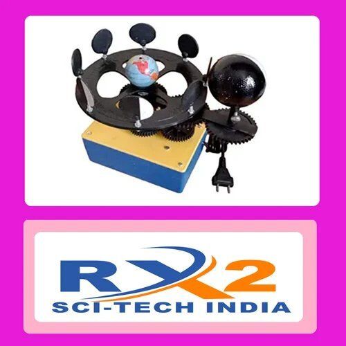
Price 10000.0 INR / Piece
Minimum Order Quantity : 1 Piece
Application : Educational purposes navigation understanding geographical learning
Material : Plastic globe metal base
Equipment Materials : Plastic and metal stand
Features : Longitude and latitude lines represented compact design
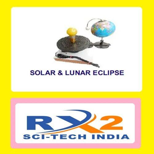
Price 1050.0 INR / Piece
Minimum Order Quantity : 5 Pieces
Application : Educational Demonstration
Material : Plastic and Metal
Equipment Materials : Plastic and Metal Components
Features : Depicts Solar and Lunar Eclipse Demonstrations
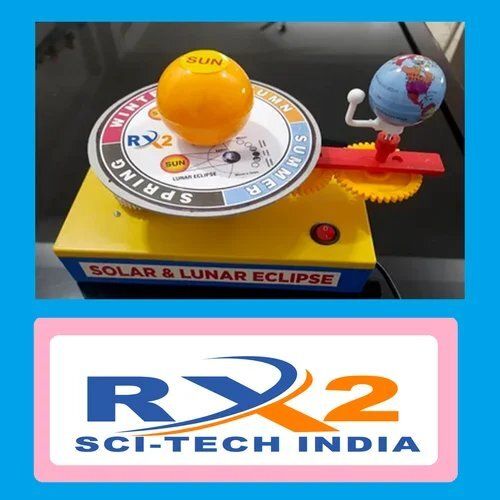
Price 1050.0 INR / Piece
Minimum Order Quantity : 5 Pieces
Application : Educational purposes to demonstrate solar and lunar eclipses
Material : Durable plastic and metal base
Equipment Materials : Plastic and metal components
Features : Demonstrates solar and lunar eclipses includes Earth Moon and Sun

 Send Inquiry
